|
Popular Birding Places |
 |
|
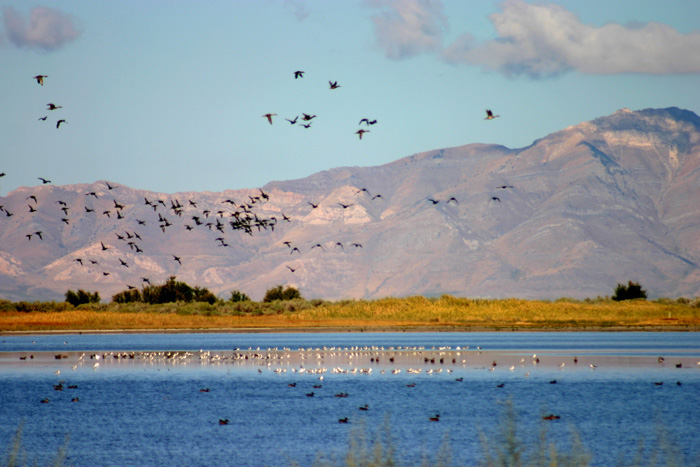
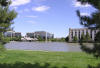
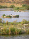
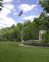
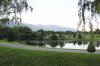
Inland Sea Shorebird Reserve by Ann Neville
©Ann Neville |
|
| Clickable Map | Printable Map with Info. | |
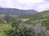
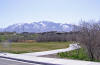
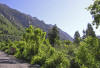
| Albion Basin |
 Directions: Take Exit 295 from I-15 in Sandy and go east on UT
209 toward the Snowbird and Alta ski resorts. Go 5 miles to the mouth of
Little Cottonwood Canyon. Go up the canyon road (UT 210) about 11 miles to
the end of the road and Albion Basin. Directions: Take Exit 295 from I-15 in Sandy and go east on UT
209 toward the Snowbird and Alta ski resorts. Go 5 miles to the mouth of
Little Cottonwood Canyon. Go up the canyon road (UT 210) about 11 miles to
the end of the road and Albion Basin. |
| Details |
|
|
 Directions: Take the 7200 South exit (Exit 297) on I-15 in Salt
Lake City and go east about 5 miles on UT 48 to the mouth of Big Cottonwood
Canyon. As the road crosses Wasatch Blvd. it joins SR190 and continues up Big
Cottonwood Canyon. Directions: Take the 7200 South exit (Exit 297) on I-15 in Salt
Lake City and go east about 5 miles on UT 48 to the mouth of Big Cottonwood
Canyon. As the road crosses Wasatch Blvd. it joins SR190 and continues up Big
Cottonwood Canyon. |
| Details |
|
Butterfield Canyon ~
submitted by Steve Carr |
 Directions:
From Bangerter Highway, take 134th South going west. Continue through
Herriman to 6400 West and turn right (north). Go about 3 block and
turn left on 13100 So. (Main St.). At about 7300 West make sure
you keep right and go about a mile to where the road makes a strong curve to
the right. Turn left at the sign for "Wild Horse & Burro Center" Directions:
From Bangerter Highway, take 134th South going west. Continue through
Herriman to 6400 West and turn right (north). Go about 3 block and
turn left on 13100 So. (Main St.). At about 7300 West make sure
you keep right and go about a mile to where the road makes a strong curve to
the right. Turn left at the sign for "Wild Horse & Burro Center" |
| Details |
|
|
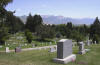 Directions: In Salt Lake City, go north on B Street from Second
Avenue (an extension of North Temple) to 11th Avenue. Turn right and go
1.2 miles to the entrance of the cemetery. The cemetery is bounded on the north
by 11th Avenue, on the west by N Street , on the east by U Street and on the
south by Fourth Avenue. Directions: In Salt Lake City, go north on B Street from Second
Avenue (an extension of North Temple) to 11th Avenue. Turn right and go
1.2 miles to the entrance of the cemetery. The cemetery is bounded on the north
by 11th Avenue, on the west by N Street , on the east by U Street and on the
south by Fourth Avenue. |
|
Details |
|
|
 Directions: From Second Avenue (an extension of North Temple) in
Salt Lake City, go north on B Street past the 11th Avenue intersection
continuing another 0.7 miles. The road crosses City Creek at the mouth of the
canyon. Directions: From Second Avenue (an extension of North Temple) in
Salt Lake City, go north on B Street past the 11th Avenue intersection
continuing another 0.7 miles. The road crosses City Creek at the mouth of the
canyon. |
|
Details |
|
Coon Canyon and
foothills along the west side of SR 111
(restricted property) |
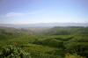 Directions: State
Route 111 can be accessed from the south by taking the I-15, 7800
South exit and going west about 9 miles. From the north you can
take the I-15, 2100 South exit and go about 11 miles to the north end of SR 111 Directions: State
Route 111 can be accessed from the south by taking the I-15, 7800
South exit and going west about 9 miles. From the north you can
take the I-15, 2100 South exit and go about 11 miles to the north end of SR 111 |
| Details |
|
Cottonwood Park, Jordan River Parkway |
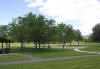 Directions: Go west on North Temple Street in Salt Lake City 2
miles past the I-15 underpass and turn right on Redwood Road. Go 0.5 miles
and turn right on 300 North. The park surrounds the Department of
Agriculture building and the Jordan River Parkway path follows the river. Directions: Go west on North Temple Street in Salt Lake City 2
miles past the I-15 underpass and turn right on Redwood Road. Go 0.5 miles
and turn right on 300 North. The park surrounds the Department of
Agriculture building and the Jordan River Parkway path follows the river. |
|
Details |
|
Cougar Park, Nature Preserve ~ submitted by Steve Carr |
 Directions: From
Bangerter Highway take 6200 South going west. Turn left at 4800 West
(just passed the railroad crossing) and continue to about 6650 South where
there is a parking lot on the left. Directions: From
Bangerter Highway take 6200 South going west. Turn left at 4800 West
(just passed the railroad crossing) and continue to about 6650 South where
there is a parking lot on the left. |
|
Details |
|
Decker Lake
(N-40.42.731, W-111.56.991) ~ submitted by Bruce Robinson |
 Directions: From Redwood Road (1700 West) in Salt Lake
City and 2495 South, go west 0.7 miles. (This is Parkway
Blvd.) Near the "Duck Crossing" sign, opposite the Franklin Covey Retail Outlet,
is a good place to park. Directions: From Redwood Road (1700 West) in Salt Lake
City and 2495 South, go west 0.7 miles. (This is Parkway
Blvd.) Near the "Duck Crossing" sign, opposite the Franklin Covey Retail Outlet,
is a good place to park. |
|
Details |
|
|
 Directions: From Exit 3 of I-215 in Salt Lake City, go
south on Wasatch Boulevard. Turn left on 3800 South and go to the fee
station of Mill Creek Canyon. Desolation Trail is 2.6 miles up the canyon
from the fee station. Directions: From Exit 3 of I-215 in Salt Lake City, go
south on Wasatch Boulevard. Turn left on 3800 South and go to the fee
station of Mill Creek Canyon. Desolation Trail is 2.6 miles up the canyon
from the fee station. |
|
Details |
|
Dimple Dell Regional Park ~ submitted by Steve Carr |
 Directions: Between Wasatch Blvd. and 1300
East just north of 10600 South. One access is about 30th East and 10000
South. Another may be at 10180 South and 30th East. There may be
other accesses as the park runs for some distance westward at about 10600 South. Directions: Between Wasatch Blvd. and 1300
East just north of 10600 South. One access is about 30th East and 10000
South. Another may be at 10180 South and 30th East. There may be
other accesses as the park runs for some distance westward at about 10600 South. |
| Details |
|
|
|
Draper/Riverton, Jordan River
Parkway |
 Directions: From Draper/Riverton Exit of I-215 (Exit
#291 -- 123rd South), go west about a mile and turn right (north) on the road
before the Jordan River bridge (on the east side of the river). Go
several hundred feet to a parking lot. Directions: From Draper/Riverton Exit of I-215 (Exit
#291 -- 123rd South), go west about a mile and turn right (north) on the road
before the Jordan River bridge (on the east side of the river). Go
several hundred feet to a parking lot. |
| Details |
|
Emigration Canyon ~ suggested by Steve Carr |
 Directions: (From the west): Go east on 500 South
in Salt Lake City. The road will start to curve south at about 1600 East until it
is heading south (at about 2100 East and 900 South). Turn left (east) on Sunnyside Avenue
(about 900 South) and continue east. You will reach the mouth of the canyon in
about 1 mile. Directions: (From the west): Go east on 500 South
in Salt Lake City. The road will start to curve south at about 1600 East until it
is heading south (at about 2100 East and 900 South). Turn left (east) on Sunnyside Avenue
(about 900 South) and continue east. You will reach the mouth of the canyon in
about 1 mile. |
|
Details |
|
|
|
Hidden Hollow Natural Area |
 Directions: From Draper/Riverton Exit of I-215 (Exit
#291 -- 123rd South), go west about a mile and turn right (north) on the road
before the Jordan River bridge (on the east side of the river). Go
several hundred feet to a parking lot. Directions: From Draper/Riverton Exit of I-215 (Exit
#291 -- 123rd South), go west about a mile and turn right (north) on the road
before the Jordan River bridge (on the east side of the river). Go
several hundred feet to a parking lot. |
| Details |
|
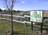
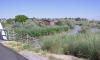
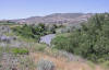
Inland Sea Shorebird
Reserve (restricted property) ~ submitted
by Steve Carr |
 Directions:
Located along I-80 north frontage road from 7200 West to where
the freeway curves to the south (~8800 West). Directions:
Located along I-80 north frontage road from 7200 West to where
the freeway curves to the south (~8800 West). |
| Details |
|
International Center
~ submitted by Tim Avery |
 Directions:
Take I-80 going west of Salt Lake City to the next exit past the Airport
exit . The center is between Wright Brothers Drive (4800 West) and
5600 West, at about 600 North. Directions:
Take I-80 going west of Salt Lake City to the next exit past the Airport
exit . The center is between Wright Brothers Drive (4800 West) and
5600 West, at about 600 North. |
|
Details |
|
Jordan Narrows
~ submitted by Steve Carr |
 Directions:
Take 14600 South west from I-15 to 1300 West where you turn left (south) and
continue on a small one-lane road for about 1/2 mile to a dirt parking area
next to the river. Park so that you
don’t block the gates. Walk in 1 – 1 ½ miles on access road. Directions:
Take 14600 South west from I-15 to 1300 West where you turn left (south) and
continue on a small one-lane road for about 1/2 mile to a dirt parking area
next to the river. Park so that you
don’t block the gates. Walk in 1 – 1 ½ miles on access road. |
| Details |
|
Jordan River Parkway
(List of several sections) |
 Cottonwood Park, Riverside Park, Murray and
Draper/Riverton Sections
Cottonwood Park, Riverside Park, Murray and
Draper/Riverton Sections |
|
Details |
|
Lee Creek Area
(Submitted by Tuula Rose) |
 Directions: From Salt Lake City, take I-80 West toward Reno to
Exit #111 (7200 West). Turn right (north) at stop sign then immediately (0.1
miles) turn left (west) onto the frontage road that parallels I-80. Drive west
on this frontage road 5.0 miles to a small parking area to the north of the
road. The parking area leads to a gated pathway that goes a short distance out
into the lake. If you are coming from the west on I-80, take the Saltair exit
#104 to get to the frontage road. Directions: From Salt Lake City, take I-80 West toward Reno to
Exit #111 (7200 West). Turn right (north) at stop sign then immediately (0.1
miles) turn left (west) onto the frontage road that parallels I-80. Drive west
on this frontage road 5.0 miles to a small parking area to the north of the
road. The parking area leads to a gated pathway that goes a short distance out
into the lake. If you are coming from the west on I-80, take the Saltair exit
#104 to get to the frontage road. |
|
|
 Directions: From I-215 exit 21, California Ave, drive west 5 miles.
(Address: 5800 W. 1400 S.) The ponds are on the south side of the road.
Turn left into the entrance with the pale brown welcome sign. Even if the gates
across the roads leading south are open, vehicle access is not permitted on
those roads. . Directions: From I-215 exit 21, California Ave, drive west 5 miles.
(Address: 5800 W. 1400 S.) The ponds are on the south side of the road.
Turn left into the entrance with the pale brown welcome sign. Even if the gates
across the roads leading south are open, vehicle access is not permitted on
those roads. . "Also you can take the 5600 West exits from either 21st South freeway (go north) or I80 (go south)." ~ Cathleen Caron |
|
|
|
|
|
Details |
|
|
 Directions: Take Exit 295 from I-15 in Sandy and go east on UT
209 toward the Snowbird and Alta ski resorts. Go 5 miles to the mouth of
Little Cottonwood Canyon. Directions: Take Exit 295 from I-15 in Sandy and go east on UT
209 toward the Snowbird and Alta ski resorts. Go 5 miles to the mouth of
Little Cottonwood Canyon. |
|
Details |
|
|
 Directions: Go about 5 miles up Parley's Canyon on I-80 and take
the UT 65 exit to East Canyon Reservoir, pass
Mountain Dell Reservoir which will be immediately on your left and go 2
mile. You can bird from the highway or at the parking lot by the
reservoir. Directions: Go about 5 miles up Parley's Canyon on I-80 and take
the UT 65 exit to East Canyon Reservoir, pass
Mountain Dell Reservoir which will be immediately on your left and go 2
mile. You can bird from the highway or at the parking lot by the
reservoir. |
|
Details |
|
|
 Directions:
Take the 106th South, (Draper/Riverton) exit (#291) from I-15 and go east to
1000 East (Carnation Dr/) and turn right (south). Continue south to 11815 South (Riparian
Drive). Turn right (west) and go west about two blocks to a small parking
lot at the bend in the road. Directions:
Take the 106th South, (Draper/Riverton) exit (#291) from I-15 and go east to
1000 East (Carnation Dr/) and turn right (south). Continue south to 11815 South (Riparian
Drive). Turn right (west) and go west about two blocks to a small parking
lot at the bend in the road. |
|
Details |
|
|
 Directions: From Second Avenue (an extension of North Temple) in
Salt Lake City, go north 0.3 miles on Canyon Road (120 East). Directions: From Second Avenue (an extension of North Temple) in
Salt Lake City, go north 0.3 miles on Canyon Road (120 East). |
|
Details |
|
|
|
Directions:
Depending on the direction your coming from take either the 3300 South or
the 3900 South exit of I-215 in east Salt Lake City. Go east under the
freeway and take Wasatch Boulevard to 3800 South. Turn east into the
canyon. |
|
Details |
|
Miller Bird Refuge and Nature Park
& Bonneville Glen ~ suggested by M. Lyman Moody |
 Directions:
North entrance (Miller Bird Refuge) - 900 South and about 1700
East Directions:
North entrance (Miller Bird Refuge) - 900 South and about 1700
EastSouthwest entrance (Bonneville Glen) - 1500 East and 1050 South.
|
|
Details |
|
|
 Directions:
Go about 5 miles up Parley's Canyon on I-80 and take the UT 65 exit to East
Canyon Reservoir, Mountain Dell Reservoir will be immediately on your left
behind the Golf Course. About 2 miles further up the road is
Little Dell Reservoir. Directions:
Go about 5 miles up Parley's Canyon on I-80 and take the UT 65 exit to East
Canyon Reservoir, Mountain Dell Reservoir will be immediately on your left
behind the Golf Course. About 2 miles further up the road is
Little Dell Reservoir. |
|
Details |
|
Murray, Jordan River Parkway |
 Directions: There are three good access points to the Murray
section of the Jordan River Parkway (which runs just west of I-15 about a half
mile to a mile). One is at 4800 South, another
is at 5400 South and a third is at 6400 South or Winchester Blvd. Directions: There are three good access points to the Murray
section of the Jordan River Parkway (which runs just west of I-15 about a half
mile to a mile). One is at 4800 South, another
is at 5400 South and a third is at 6400 South or Winchester Blvd. |
|
Details |
|
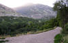
Parley's Canyon ~ submitted by Steve Carr |
 Directions:
I-80 passes through Parley's Canyon as it heads east from Salt Lake City. Directions:
I-80 passes through Parley's Canyon as it heads east from Salt Lake City. |
| Details |
|
Parley's Historic and Nature Area
/ Parley's Gulch |
 Directions:
Take the 2300 East Street exit (Exit 171) from I-80 in south Salt Lake City.
Turn left on Heritage Way (2760 South) and go to 2700 East. Directions:
Take the 2300 East Street exit (Exit 171) from I-80 in south Salt Lake City.
Turn left on Heritage Way (2760 South) and go to 2700 East. |
|
Details |
|
Red Butte Gardens
(submitted by Carol Gwynn) |
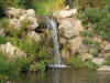 Directions: Take Wakara Way (about 650 south) east off of Foothill Blvd.
(an extension of 500 South that curves southeast) to
Red Butte Gardens. Directions: Take Wakara Way (about 650 south) east off of Foothill Blvd.
(an extension of 500 South that curves southeast) to
Red Butte Gardens. |
|
Details |
|
Riverside Park (and Rose
Park), Jordan River Parkway |
 Directions: Go west on North Temple Street in Salt Lake City 2
miles past the I-15 underpass and turn right on Redwood Road. Go to 700
North and turn right, continuing a short distance to the parks on the east side
of the river. Directions: Go west on North Temple Street in Salt Lake City 2
miles past the I-15 underpass and turn right on Redwood Road. Go to 700
North and turn right, continuing a short distance to the parks on the east side
of the river. |
|
Details |
|
Riverton/Draper, Jordan River Parkway (see Draper/Riverton section)
|
|
Saltair Marina and ponds (see South Shore)
|
|
Sandy Pond (Sandy
Urban Fishery or Sandy Fishing Pond) |
 Directions: Located
at 900 West and 100th South in Sandy, Utah Directions: Located
at 900 West and 100th South in Sandy, Utah |
|
Details |
|
|
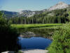 Directions: Take the 7200 South exit (Exit 297) on I-15 in Salt
Lake City and go east about 5 miles on UT 48 to the mouth of Big Cottonwood
Canyon. Go up the canyon 14 miles on UT 190 to Brighton. Silver Lake
is behind the Nordic Center on the one-way loop at the end of the road. Directions: Take the 7200 South exit (Exit 297) on I-15 in Salt
Lake City and go east about 5 miles on UT 48 to the mouth of Big Cottonwood
Canyon. Go up the canyon 14 miles on UT 190 to Brighton. Silver Lake
is behind the Nordic Center on the one-way loop at the end of the road. |
|
Details |
|
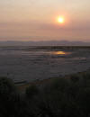
South Shore -- Great Salt Lake /
GSL Marina / Saltair |
 Directions: Take I-80 going west from Salt Lake City to Exit 104
(Saltair). Take the frontage road heading northeast. From this point
to Saltair (an old resort six mile down the road), there are points of access,
mostly by foot to the mudflats of the Great Salt Lake. Directions: Take I-80 going west from Salt Lake City to Exit 104
(Saltair). Take the frontage road heading northeast. From this point
to Saltair (an old resort six mile down the road), there are points of access,
mostly by foot to the mudflats of the Great Salt Lake. |
|
Details |
|
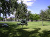
|
 Directions: Sugarhouse Park is accessed at 1500 East and 2100
South in Salt Lake City. ~ Carol Gwynn Directions: Sugarhouse Park is accessed at 1500 East and 2100
South in Salt Lake City. ~ Carol Gwynn |
| Details |
|
|
 Directions: Take Exit 295 from I-15 in Sandy and go east on UT
209 toward the Snowbird and Alta ski resorts. Go 5 miles to the mouth of
Little Cottonwood Canyon. Go up the canyon road (UT 210) about 4
miles. Tanner's Flat Campground will be on your right, south of the road. Directions: Take Exit 295 from I-15 in Sandy and go east on UT
209 toward the Snowbird and Alta ski resorts. Go 5 miles to the mouth of
Little Cottonwood Canyon. Go up the canyon road (UT 210) about 4
miles. Tanner's Flat Campground will be on your right, south of the road. |
|
Details |
|
Tanner Park and Parley's Gulch |
 Directions: Take the 2300 East Street exit (Exit 171) from I-80
in south Salt Lake City. Turn left on Heritage Way (2760 South) and go to
2700 East. You can use the parking lots for Parley's Historic and Nature
Area or for Tanner Park. Directions: Take the 2300 East Street exit (Exit 171) from I-80
in south Salt Lake City. Turn left on Heritage Way (2760 South) and go to
2700 East. You can use the parking lots for Parley's Historic and Nature
Area or for Tanner Park. |
| Details |
|
|
 Directions: Take the 7200 South exit (Exit 297) on I-15 in Salt
Lake City and go east about 5 miles on UT 48 to the mouth of Big Cottonwood
Canyon. Go up the canyon 10 miles to the campground on the right. Directions: Take the 7200 South exit (Exit 297) on I-15 in Salt
Lake City and go east about 5 miles on UT 48 to the mouth of Big Cottonwood
Canyon. Go up the canyon 10 miles to the campground on the right. |
| Details |
|
Wasatch Hollow Park (Hollow Park)
~ submitted by Tom Fletcher |
 Directions: Wasatch Hollow Park is northwest of the 1700 East
and 1700 South intersection. Directions: Wasatch Hollow Park is northwest of the 1700 East
and 1700 South intersection. |
|
Details |
|
Washington Park |
 Directions:
Go about 4 miles up Parley's Canyon on I-80 and take
the UT 65 exit (#134). After you go under I-80,there's a road that takes
off to the right (east) which passes the golf course club house in about a half
mile and ends up in Washington Park in another half mile. Directions:
Go about 4 miles up Parley's Canyon on I-80 and take
the UT 65 exit (#134). After you go under I-80,there's a road that takes
off to the right (east) which passes the golf course club house in about a half
mile and ends up in Washington Park in another half mile. |
|
Details |
|
Yellow Fork Canyon
~ submitted by Steve Carr |
 Directions:
Take 13400 South west from Bangerter Highway to
the center of Herriman. At 6400 West (Rose Canyon Road), turn left (south) and
go about 1/2 mile to where Rose Canyon
Road takes off to the right. Follow this road for about 3 1/2 miles to the
parking lot for Yellow Fork Canyon. Directions:
Take 13400 South west from Bangerter Highway to
the center of Herriman. At 6400 West (Rose Canyon Road), turn left (south) and
go about 1/2 mile to where Rose Canyon
Road takes off to the right. Follow this road for about 3 1/2 miles to the
parking lot for Yellow Fork Canyon. |
|
Details |
|
|