|
Popular Birding Places
Carbon County
|
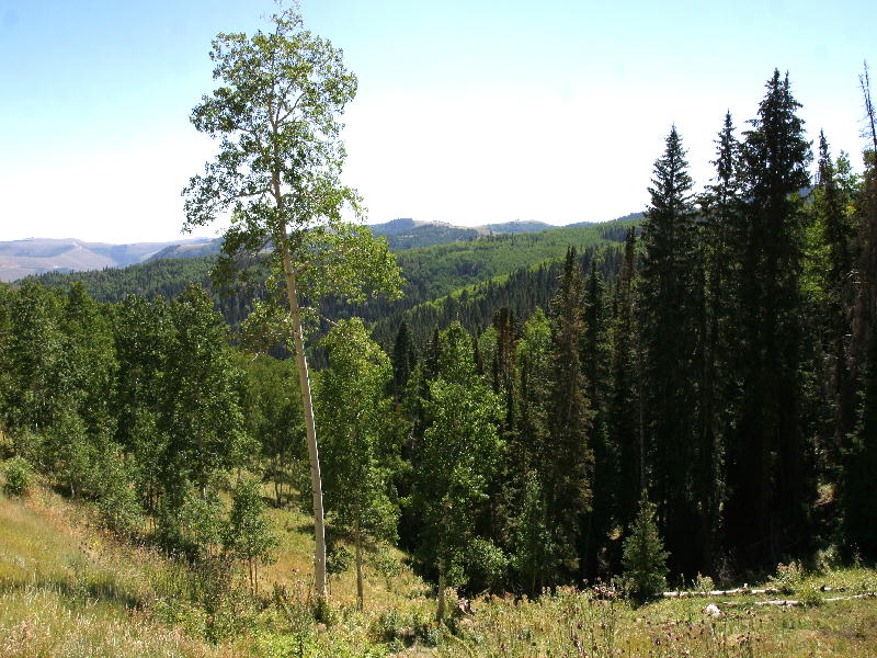 |
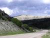
Clear Creek 31 Aug 2002 by Jack Binch
©Jack Binch
|
| (To print a county map along with this information,
go to the Print
Center) |
Clark Valley Reservoir
Directions: From Hwy 6 and 191 about 14 miles east of
Price take Clark Valley Road and go 5 or 6 miles to the Reservoir.
eBird Data: |
Clarks Valley Reservoir |
|
Emma Park Road (Submitted by Eric Huish)
 |
Directions: About 10.5 miles SE of
Soldier Summit on US 6, is a signed turnoff to Emma Park Road. Go about 3.8
miles to the mile or so stretch of road that is know for its birds. |
|
Details |
|
Fish Creek (Fish Creek National
Recreation Trailhead) (Submitted by Merrill Webb)
 |
Directions: From the junction of Myrtle St. and Church St. in Schofield,
turn north towards the reservoir. Follow the road along the west side of the
reservoir for 1.6 miles to where Fish Creek comes in from the west. Turn
left (west) and follow the road about 3.8 miles to the trailhead where there is
a small campground. |
|
Details |
|
Gordon Creek State Wildlife
Management Area (Submitted by Eric Huish)
 |
Directions: From Hwy 6 turn West on Consumers Road about 2 miles South of
Helper or almost 5 miles North of Price (N 39̊ 39.130' W 110̊ 51.630'). Gordon
Creek State Wildlife Management Area is about 7 miles up Consumers Road. |
|
Details |
|
Indian Canyon (in
Carbon and Duchesne Counties)
 |
Directions: About 3 miles north of Helper on Hwy. 6, take Hwy. 191
which heads in a generally northeast direction to Duchesne. |
|
Details |
|
Price to Sunnyside
Directions: Turn off Hwy 6, 191 at 100 North into Price. Start
with Pioneer Park (100 East 550 North) & Washington Park (150 East
450 North) and the College of Eastern Utah (451 East 4th North). Then take
Main Street going east to get back on Hwy 6 and 191 going southeast out of
Price. About 9 miles past Wellington turn left on SR 123 and proceed to
Sunnyside about 8 miles away.
eBird Data: |
Pioneer & Washington Parks
| College of Eastern Utah
| East Carbon WTP
|
| Farnham Rd -- Price
River Valley |
Sunnyside Park |
| Grassy Trail Reservoir
& Lower Whitmore Canyon |
|
Price Canyon Recreation Site (discovered by Eric Huish)
 |
Directions: About 13.7 miles SE of
Soldier Summit on US 6, is a turnoff on the southwest side of the road to a
paved one-lane road that leads to the camping and picnic areas about 3 miles
up the mountain. |
|
Details |
|
River Walkway in Helper
(submitted by Robin Tuck)
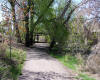 |
Directions: Turning east off
Highway 6 onto Helper Main Street (State Highway 157) and bend immediately
to the south. After two blocks, angle west (right) onto First Street where
parking for 6 cars can be found. Restrooms are about a block south. The
paved walkway extends both north and south from the parking lot. |
|
Details |
|
Scofield Reservoir
 |
Directions: 1. West approach: Take US 6 going up Spanish Fork
Canyon. Go 23 miles past the Thistle junction, and turn right on UT
96 heading west then south about 16 miles to the reservoir.
2. East approach: Go about 14 miles northwest of Helper on US
6 and turn left on UT 96 heading west then south about 16 miles to the
reservoir. |
|
Details |
|
Spring Canyon Trail
 |
Directions: In Helper, Utah. Turn South off U.S. Route 6 onto
Bryner Street or turn West off 6 onto N Main then turn left onto Bryner. Turn
Right off Bryner onto Spring Canyon Street. Follow Spring Canyon Street up the
canyon. |
|
Details |
|

|