|
Popular Birding Places
Sanpete County |
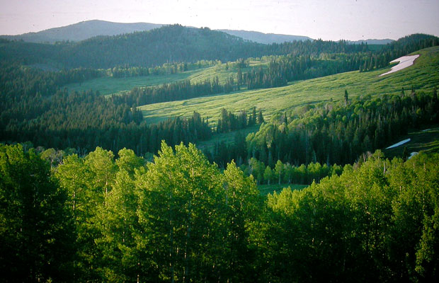 |
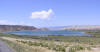
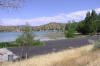
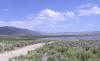
| Skyline Drive, Wasatch Plateau by Merrill Webb
©Merrill Webb |
|
Chester Ponds ~
submitted by Oliver Hansen
 |
Description: Chester is found east of Wales, south of Moroni, and west
of Spring City. There are many ponds in the area to the north of town. The
majority of these ponds can be viewed from a small gravel road running from HWY
89 to 132.
|
|
Details |
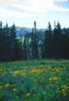
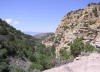
Fairview Canyon
 |
Directions: From Hwy 89 in Fairview turn east at the sign for
Fairview Canyon, Scofield and Huntington Canyon -- it's well marked.
|
|
Details |
Fayette River Bottoms |
 |
Directions: Turn west off of UT 28, just south of Fayette at
mile marker 4 near the "Warm Springs Ranch House" and go about 0.2 miles toward
Fayette. Turn left on Fayette River Lane (3750 South) and continue west
cutting through a wetland and across a bridge about a half mile away
|
|
Details |
|
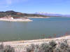
Gunnison Reservoir |
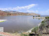 |
Directions: As you enter the town of Sterling, there's a road going to
the west which goes to the reservoir. (Going east is the road to Palisade Park).
About 1/3 of a mile down the road if you bare left and then go straight you'll
come to the dam.
|
|
Details |
|
Manti Canyon |
 |
Directions: From Main Street in Manti (US 89) take 500 South
going east. At the mouth of the canyon, just outside of town, the road
becomes Manti Canyon Road and continues about 20 miles through the canyon
connecting with Skyline Drive, which runs north and south through the tops of
the mountains of the Wasatch Plateau.
|
|
Details |
|
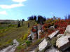
Maple Canyon
~ submitted by Bruce Robinson
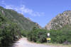 |
Directions: At the eastern end of Fountain Green, bear right
towards Wales. After 1/2 mile the main road bears left, stay on this road. At
6.1 miles from the start
you will come to the road marked "Freedom Cemetery", turn right onto this road
and go 0.6 of a mile. Turn right and follow the road. The pavement ends about
1.6 miles from the last turn. Continue on the dirt road for 1.5 miles to the
Maple Canyon Campground.
|
|
Details |
Mayfield - Ferron Road
(see Ferron Canyon) |
Ninemile Reservoir
 |
Directions: Go south from Sterling on US 89 about 2 miles.
The reservoir is on the west side of the road at the Mayfield turnoff.
|
|
Details |
|
Palisade State Park
 |
Directions: From just inside the north city limits of Sterling
take the well-signed road going east to Palisade State Park about 2 miles away.
|
|
Details |
Sevier Bridge Reservoir (See
Yuba State Park - Painted Rocks)
|
Sixmile Canyon
 |
Directions: From just inside the north city limits of Sterling
take the road going east to Palisade State Park. After about 1 1/2 miles
turn off to the right where there is a sign. In about 2.8 miles birding
along this dirt and gravel road you will reach a good parking area as the canyon
broadens out.
|
|
Details |
Skyline Drive - North
~ submitted by Eric Huish |
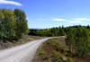 |
Directions: The Skyline Drive is
one of the highest roads in the United States. The full drive is 87 miles long
and traverses the summit of the Wasatch Plateau with mountain meadows, Fir and
Aspen Forests and fantastic views in all directions. The north section (27
miles) between Tucker (U.S. 6) and Fairview Canyon (Hwy 31) is not as high as
the drive South of Fairview Canyon, but is a much nicer, graded road suitable
for travel in any kind of vehicle.
|
|
Details |
|
Skyline Drive - South
~ submitted by Eric Huish |
 |
Directions: One way to access the Skyline Drive South section is to
drive up Fairview Canyon (Hwy 31). Near the top of the canyon I think there is a
sign (across from the turn off to Lower Gooseberry Reservoir and the Ranger
Station) that says 'South Skyline Drive', turn right (Hwy 31). Then there should
be another sign a few miles down the road, turn right again.
|
|
Details |
|
Wales Reservoir
 |
Directions: (From Wales) Go East on 300 North in Wales. Turn left when you have
to, then after a short distance turn right onto 15500 North or Wales Reservoir
Road. Go east to 1000 East and turn left (north) and continue a short
distance to the reservoir.
|
|
Details |
|
Yuba State Park - Painted
Rocks |
 |
Directions: From UT 28 about 15 miles south of Levan or about 15
miles north or Gunnison, turn west on the short road to the state park.
|
|
Details |
|
|
|

|