|
Provo Airport Dike |
 |
|
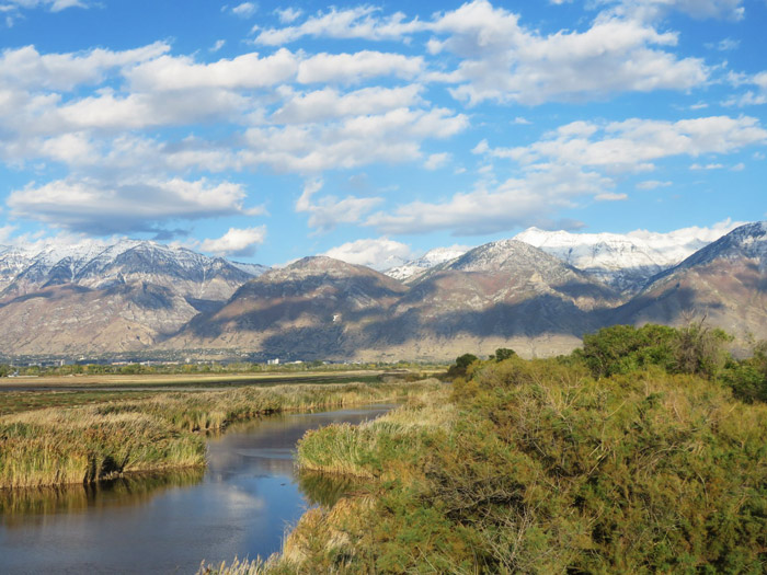
Early Autumn, from the Southwest Corner |
|
|
|
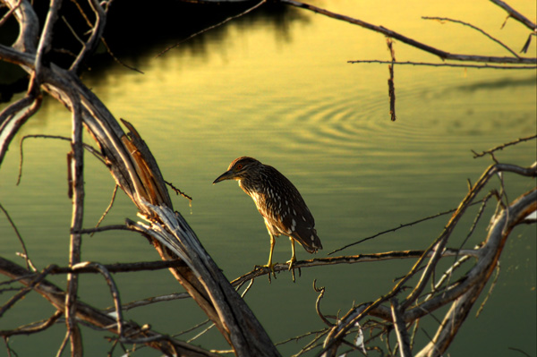
Construction of new access roads and construction along the East side of the Airport means the the "Old Directions" have become outdated. We will have directions for the East side when the construction is complete and we know what will be accessible for birding in the future. Birding the West side: Approach is from Provo Center St. on the west side of I-15. Going west on Center St., take the small road going left, just before you get to the bridge over the Provo River, near the entrance to the Utah Lake State Park. About 200 yards down the road you'll come to the sign restricting further car traffic. Car traffic to the control tower is limited to Airport Employees only, but you can park your car and continue on by foot. Watch for instructions for the East side of the Airport when the construction has been completed. Old Directions: To get to the Airport Dike (see Provo Airport Area Map), take the Provo Center Street exit off I-15 (#265). Continue west on Center Street towards the Provo Boat Harbor. The Airport road, 3110 West, runs south off Center street about one mile past the Geneva road intersection and is marked by a sign saying "Airport". Turn left here and go 0.9 miles to the beginning of the Provo Airport Dike, N 40 13.548' W 111 42.794'. Birding: This is a good place to get out of the car and start birding. When you continue in the car, drive slowly, being on the lookout for birds on both sides of the road. Continue south to the next stop, 0.7 miles further on, where you will be able to see Utah Lake. Here there is a road to the left blocked by a gate where a walk can sometimes be very rewarding. The road turns west (right) then goes around the south runway approach section, then continues west to the south west corner where it turns north (again to the right). Along this stretch of road, the lake is visible on the left and the moat is on the right. There are several points along the road where you can pull off for a closer look. The road continues north for 1.5 miles to the northern runway approach where it bends west out into the lake providing good views into the marshes. The road continues around the runway extension, then angles north paralleling the Provo River until it returns to Center Street. Here, Center Street crosses over the Provo River on a bridge that has a nesting colony of Cliff Swallows in May and June. Birds: The birds commonly seen on this auto tour include several species of swallows, both Western and Eastern Kingbirds, Great Blue Herons, Black-crowned Night Herons, Snowy Egrets, Forster’s and Caspian Terns, Marsh Wrens, Lazuli Buntings, Blue Grosbeaks, and several species of water fowl. (Sometimes, during spring and fall migrations, this area is one of the best places to find uncommon birds.) ~ Robin Tuck eBird Data: |
Provo Airport Dike | Field Trip Reports: |
20
Aug 2011 |
24 May 2011
| 30
Apr 2011 |
28 Apr 2008 |
21 Oct 2006 | |
|
|
 |
|
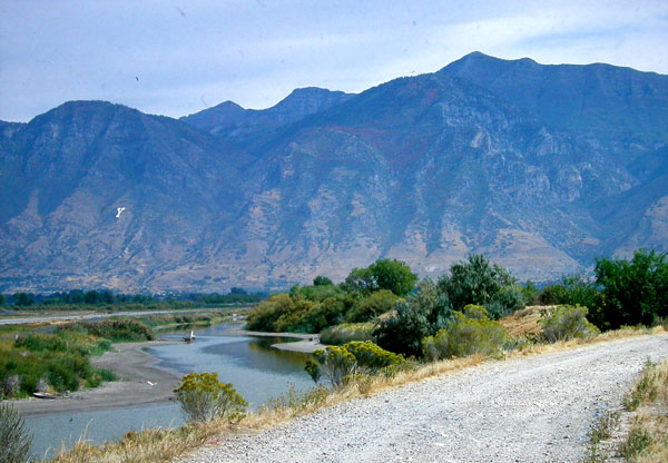
Provo Airport Dike Looking East |
 |
|
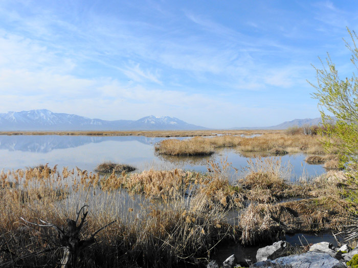
Looking South from the South Side |
 |
|
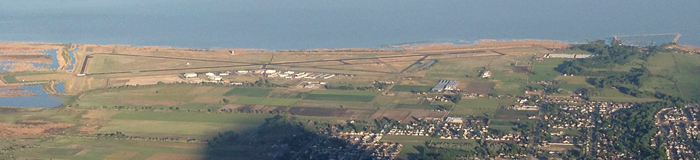
Provo Airport and Boat Harbor |
 |
|
Juvenile Black-crowned Night-Heron
|
|
|