|
Popular Birding Places |
||||||||||||
 |
||||||||||||
|
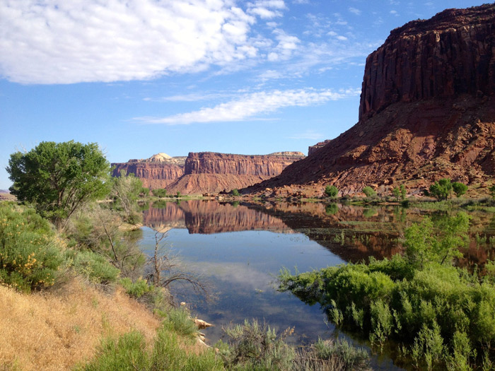
Indian Creek Reservoir by Matthew Van Scoyoc
Jun 2014 ©Matthew Van Scoyoc |
||||||||||||
|
(To print a county map along with this information,
go to the Print
Center) |
||||||||||||
|
Abajo Mountain and Harts Draw Loop [Utah Birding Trails] eBird Data: |
Dalton Springs | eBird Data: |
Blanding Treatment Ponds |
Westwater Creek -- Just W of
Blanding | eBird Data: |
Sand Island CG & Bluff Road
Bridge | Navajo
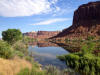
Twins Ponds | Directions: Access to the park NORTH of the Colorado River is on Hwy 313 which takes off of Hwy 191 about 14 miles north of Moab. eBird Data: |
Canyonlands NP -- Visitor
Center -- Island in the Sky | Access to the park SOUTH of the Colorado River is on Hwy 211 which takes off of Hwy 191 about 15 miles north of Monticello. (Listed by distance along Hwy 211 from the Hwy 191 intersection) eBird Data: |
Indian Creek Canyon |
Newspaper Rock CG | Comb Wash [Utah Birding Trails] eBird Data: |
Comb Wash | Directions: Access to Dead Horse Point SP is from Hwy 313 which takes off of Hwy 191 about 14 miles north of Moab. (Canyonlands NP is on the South Fork Rd which takes off of Hwy 313 before it get to Dead Horse Point). eBird Data: |
Dead Horse Point SP |
-- Rim Trail | Devil Canyon Campground [Utah Birding Trails]
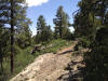
Elk Ridge Loop [Utah Birding Trails] Directions: Go south of Blanding on US 191 4 miles and turn right on UT 95. Go 5.5 miles and turn right on Cottonwood Road (FR 106). Go 25 miles north to FR 095, turn left and go 2.5 miles to FR 088 and turn left. The 11 miles stretch of FR 088 goes from North Elk Ridge to Elk Ridge and an intersection with FR 092. From this intersection you can go east on FR 092 and reconnect with Cottonwood Road or you can goes southwest on FR 088 and reconnect with UT 95 near Natural Bridges Nation Monument. eBird Data:
| Hwy 95 -- Westwater
Creek | --
Cottonwood Creek | Comb
Wash | Directions: Go south of Blanding on US 191 4 miles and turn
right on UT 95. Go 34 miles and turn left going south on UT 261 towards
Grand Gulch Primitive Area and Mexican Hat. Go about 5 miles and turn east
on a dirt road which lead to Fish Creek Canyon 5 miles away. (Same trailhead as
Owl Creek Canyon) The Goosenecks of the San Juan SP Directions: Go west of Bluff on Hwy 163 about 22 miles and bare right on Hwy 261 (Mexican Hat is 3 miles to the left -- south). Go a little over a mile and turn left on Hwy 316 and go about 4 miles to the state park. eBird Data: |
San Juan SP -- The Goosenecks
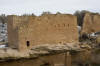
| Hackberry Ruins, Hovenweep NM anding on US 191 about 14 miles and turn left on UT 262 (Hovenweep road). Follow the signs to Hovenweep National Monument. Check in at the ranger station at the Square Tower unit to let them know you're there and for direction to the Hackberry Ruins. eBird Data: |
Hatch Trading Post |
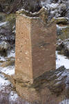
Hovenweep NM |
Lloyd's Lake [Utah Birding Trails] eBird Data: |
Lloyds Lake | Montezuma Canyon [Utah Birding Trails] eBird Data: |
Montezuma Creek Rd -- Lower
| Montezuma Creek Ranch
-- Pond | eBird Data: |
Lloyds Lake |
Clay Hill Rd |
Bronson Rd -- Junipers |
Gordon Reservoir | eBird Data: |
Natural Bridges NM |
-- Natural Bridges CG | Directions: Go south of Blanding on US 191 4 miles and turn right on UT 95. Go 34 miles and turn left going south on UT 261 towards Grand Gulch Primitive Area and Mexican Hat. Go about 5 miles and turn east on a dirt road which lead to Fish Creek Canyon 5 miles away. (Same trailhead as Fish Creek Canyon) eBird Data: | Grand
Gulch Ranger Station | Directions: The reservoir is located north of Blanding on US 191 about 4 miles. There are access roads to both the east and west sides. Description: Merrill Webb's Description eBird Data: |
Recapture Reservoir | Sand Island Recreation Area [Utah Birding Trails] Directions: Go west of Bluff about 3 miles on UT 163 and turn left into the Sand Wash Recreation Area. This road leads to the campground and restrooms. eBird Data:
| Sand Island CG & Bluff
Road Bridge | South Elk Ridge [Utah
Birding Trails] Square Tower Loop, Hovenweep NM
|
||||||||||||
|
|
||||||||||||