|
Popular Birding Places |
 |
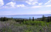
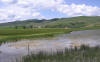
| Bear Lake Valley by Eric Huish ©Eric Huish |
|
(To print a county map along with this information, go to the Print Center) |
|
|
|
|
|
Details |
|
|
|
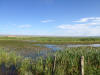
Bear River Meadows
(a.k.a. Randolph viewing area and Bear River Wetlands) |
|
|
|
Details |
|
|
 Directions: From the intersection by the "Rock Store" in the
center of Laketown (just off UT 30, at the south end of Bear Lake) go west
about 3 miles to a "T" in the road. Turn right going toward Meadowville (left
going toward Round Valley) and go about a 100 yards to where the road crosses
Big Creek. Directions: From the intersection by the "Rock Store" in the
center of Laketown (just off UT 30, at the south end of Bear Lake) go west
about 3 miles to a "T" in the road. Turn right going toward Meadowville (left
going toward Round Valley) and go about a 100 yards to where the road crosses
Big Creek. |
|
Details |
|
|
|
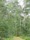
Birch Creek Reservoirs
~ submitted by Kristin Purdy |
 Directions:
From Woodruff, proceed west 8-9 miles on UT 39. The unimproved road to Birch
Creek Reservoir is a right (north) turn and located between mm 61 and 60.
The road is marked by a low brown sign that indicates Public Camping, 1
mile. Drive the mile and park at the fenced area next to the old
reservoir.,, Directions:
From Woodruff, proceed west 8-9 miles on UT 39. The unimproved road to Birch
Creek Reservoir is a right (north) turn and located between mm 61 and 60.
The road is marked by a low brown sign that indicates Public Camping, 1
mile. Drive the mile and park at the fenced area next to the old
reservoir.,, |
|
Details |
|
|
|
Crawford Mountain Road See Bear River Meadows |
|
|
| Dairy Ridge and Eli
Ridge Roads
(accessed through Weber County) |
|
|
|
|
Directions: The reservoir is located about 3 miles west of Randolph. The Old Canyon and New Canyon roads west of the reservoir can provide good birding. eBird Data: |
Bear River Meadows |
Sage Creek Junction
| |
|
|
|
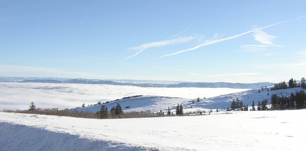
Monte Cristo Campground ~
submitted by Kris Purdy |
 Directions:
Take SR-39 north and east from I-15 exit 344 in Ogden or pick
it up at the intersection with SR-167 (end of Trapper's Loop) in Ogden Valley,
Weber County. From Rich County, pick up SR-39 in Woodruff at the intersection
with SR-16. Monte Cristo Campground is located on SR-39 at mile 47.7. Directions:
Take SR-39 north and east from I-15 exit 344 in Ogden or pick
it up at the intersection with SR-167 (end of Trapper's Loop) in Ogden Valley,
Weber County. From Rich County, pick up SR-39 in Woodruff at the intersection
with SR-16. Monte Cristo Campground is located on SR-39 at mile 47.7. |
|
Details |
|
|
|
|
|
Directions: Go 6 miles north of Sage Creek Junction and turn left on Six Mile Road. The reservoir is about a mile down the road. eBird Data: |
Sixmile Reservoir |
Sage Creek Junction
|
Bear River Meadows | |
|
|