| |
Possible Routes for
Bryce CBC:
(From 2013)
Route #1
Ruby’s Inn area (including open water near Ruby’s and Forest Service Roads
between Ruby’s and park HQ) and park developed areas on the East side of the
road including North Campground, Fairyland/Sunrise/Sunset/Inspiration/Bryce/Paria
Viewpoints, historic housing, and Lodge area. Also, all birds seen from road
between Ruby’s Inn and turn off to Bryce/Paria viewpoints. Mostly driving and
some walking – Easy.
Route #2
Park developed areas on the West side of the road including park residential
housing area, Visitor Center, Sewage lagoons, Sunset Campground, Mixing Circle
and the Forest Service road to the west of the Mixing Circle to East Creek
Meadow. Mostly driving and walking, may require high clearance or 4x4 on Forest
Service Road – Easy.
Route #3
Town of Cannonville (off of HW 12) to junction with Yellow Creek. Mostly driving
on paved road – could be combined with another route – Easy.
Route #4
Tropic Area (off of HW 12) – possibly 3 groups if enough volunteers:
From Bryce Valley High School west to Campbell Creek Loop and Tropic Connector
Trail
Town of Tropic on West side of HW 12
Town of Tropic on East side of HW 12 to edge of count circle including walk
along Paria
Mostly driving with some walking around – Easy to Moderate.
Route #5
Park Road from the turn off to Bryce/Paria viewpoints to Rainbow point,
including all pull-outs between (except Yovimpa point). Black rosy finch and
pygmy owl seen along this route in past years! Mostly driving and stopping –
Easy. Could be combined with some Below-the-Rim snowshoeing for the adventurous
types!
Route #6
Fairyland Loop trail – 8 miles of hiking with good footwear – Difficult and not
too many birds (for the hard-core birders).
Route #7
Tropic Trail (3.6 miles total) – could be combined with Peek-a-Boo Loop (another
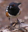
5.5 miles). Good route for scrub/pinyon jays, ravens, chickadees, etc. All
hiking/snowshoeing – Moderate to Difficult depending on chosen route.
Route #8 (weather dependent)
Dave’s Hollow, Blue Fly, Johnson Hollow and East Creek Meadow (from Tropic
Reservoir Road to Park Service Wells). Mostly driving and hiking on the Forest –
may require 4x4 vehicle to access some areas – Easy to Moderate.
Route #9 (weather dependent)
Tropic Reservoir, East Fork, Blubber, Skunk, and side drainages. Mostly driving
with some walking – Easy.
Route #10
Highway 12 Driving and stopping from East of Cannonville to Ruby’s Inn & Mossy
Cave (.8 mile roundtrip) and the Paria River directly across from Mossy Cave
trailhead. Mostly driving on pavement with a short hike to Mossy Cave and along
the Paria – Easy to Moderate.
Route #11
Bulldog Hollow, Sheep Creek, Yellow Creek, Willis Creek – driving routes over
rough terrain – 4x4 vehicle required. Road access/condition may limit some of
these routes. Lots of driving but good bird diversity/numbers! Route for those
folks who like getting off the beaten track! Easy on the feet, tough on the
vehicle.
Route #12
Queen’s Garden and Navajo Loop (2.9 miles hike within the park). May require
snowshoes – Moderate to Difficult.
Route #13
Swamp Canyon to Sheep Creek – can be done as a loop (~7 miles hike within the
park). May require snowshoes – Moderate to Difficult.
Route #14
Yellow Creek/Hat Shop (~6 miles hike from Bryce Point to good riparian habitat).
May require snowshoes – Moderate to Difficult.
Route #15
The Rim Trail - A great winter workout! Fairyland to Bryce Point (~5 mile
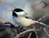
snowshoeing). Chickadees, juncos and nuthatches abound! The birds really like
this edge habitat between plateau and rim! A drop-off/pickup can be arranged at
Fairyland and Bryce Points. Moderate.
Route #16
Ruby’s Inn ski loops between Ruby’s and Fairyland Point (various routes 2-8
miles). Moderate.
Sarah Haas
Biologist
Bryce Canyon National Park
P.O. Box 640201
Bryce, UT 84764
Mon - Thurs: 435.834.4753
Fridays/Cell Phone: 435.690.9558
Fax: 435.834.4703
|
|